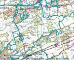
i'm currently undertaking a series of town population studies in the UK. i have all the data now sorted into seperate excel files, and also have jpeg map images of each of the population areas i have coverered ..... but instead of the client having to open each file individually and then match the map image with the are i would like to build a database where as to the image will be shown alongside the data ..... it shouldnt be too difficult, but i'm not too fluent with access yet ..... can anybody offer us any pointers? cheers in advance 
examples of the data i want to be shown next to each other are ahown below. i presume i can simply copy and paste the excel data into a database, but dont know how to go about getting the relative maps to appear next to the data.
Danny
WEST LOTHIAN COUNCIL AREA
ALL PEOPLE AREA (HECTARES) Density (number of persons per hectare)
SUMMARY 158714 42860.74 3.7
Almond 4787 1290.27 3.71
Armadale Central 4455 433.62 10.27
Armadale West 4966 2244.91 2.21
Blackburn 5192 2243.52 2.31
Boghall 4287 111.66 38.39
Breich Valley 5273 6148.47 0.86
Calderwood 5094 1131.4 4.5
Carmondean 5504 114.43 48.1
Craigshill 4628 332.97 13.9
Croftmalloch 4633 118.2 39.2
Deans 5425 315.93 17.17
Dedridge 5405 120.3 44.93
Durhamtoun 3861 1048.88 3.68
East Calder 4999 244.37 20.46
Easton 4675 194.96 23.98
Fauldhouse 5154 2209.8 2.33
Houstoun 4704 520.7 9.03
Howden 5515 302.98 18.2
Kingsfield 5630 3432.22 1.64
Kirkton 4987 327.09 15.25
Knightsridge 5728 381.37 15.02
Ladywell 4893 135.78 36.04
Limefield 4752 387 12.28
Linhouse 5118 6945.62 0.74
Middleton 4729 177.81 26.6
Murieston 5174 784.81 6.59
Newland 4478 739.81 6.05
Oatridge 4782 2530.38 1.89
Polkemmet 4584 1809.83 2.53
Preston 5902 5307.26 1.11
St Michael's 4818 527.5 9.13
Strathbrock 4582 246.89 18.56
examples of the data i want to be shown next to each other are ahown below. i presume i can simply copy and paste the excel data into a database, but dont know how to go about getting the relative maps to appear next to the data.
Danny

WEST LOTHIAN COUNCIL AREA
ALL PEOPLE AREA (HECTARES) Density (number of persons per hectare)
SUMMARY 158714 42860.74 3.7
Almond 4787 1290.27 3.71
Armadale Central 4455 433.62 10.27
Armadale West 4966 2244.91 2.21
Blackburn 5192 2243.52 2.31
Boghall 4287 111.66 38.39
Breich Valley 5273 6148.47 0.86
Calderwood 5094 1131.4 4.5
Carmondean 5504 114.43 48.1
Craigshill 4628 332.97 13.9
Croftmalloch 4633 118.2 39.2
Deans 5425 315.93 17.17
Dedridge 5405 120.3 44.93
Durhamtoun 3861 1048.88 3.68
East Calder 4999 244.37 20.46
Easton 4675 194.96 23.98
Fauldhouse 5154 2209.8 2.33
Houstoun 4704 520.7 9.03
Howden 5515 302.98 18.2
Kingsfield 5630 3432.22 1.64
Kirkton 4987 327.09 15.25
Knightsridge 5728 381.37 15.02
Ladywell 4893 135.78 36.04
Limefield 4752 387 12.28
Linhouse 5118 6945.62 0.74
Middleton 4729 177.81 26.6
Murieston 5174 784.81 6.59
Newland 4478 739.81 6.05
Oatridge 4782 2530.38 1.89
Polkemmet 4584 1809.83 2.53
Preston 5902 5307.26 1.11
St Michael's 4818 527.5 9.13
Strathbrock 4582 246.89 18.56


